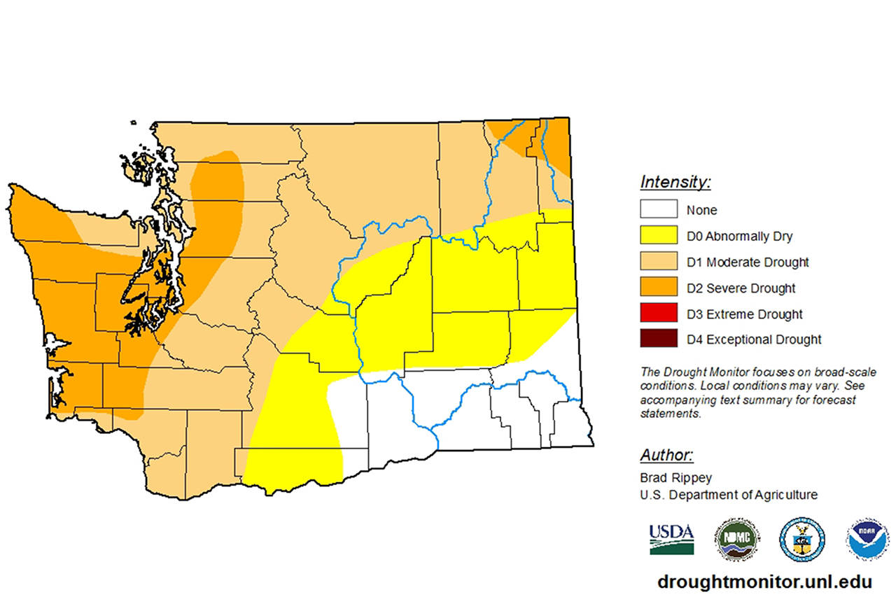
Ecologists are seeing record-low streamflows across Washington state, and though it hasn’t hit a low the Dungeness River is much lower than normal.
While several watersheds in the area are considered to be in more severe stages of drought, the Dungeness watershed that includes the Sequim area is considered in a “moderate” drought according to Mark Mastin, a United States Geological Survey data chief and surface water specialist.
On July 10, the Dungeness River Management Team met in their regular board meeting to see several different presentations, including a USGS presentation about water flow in the Dungeness River and the potential drought-related implications of it.
In May, Clallam County was added to a sweeping drought declaration by Gov. Jay Inslee, under the direction of the state Department of Ecology. All of the Olympic Peninsula was included in this declaration, as well as much of southwest Washington state, the northern Puget Sound region, much of the Cascades and several eastern Washington watersheds.
While the Sequim area is only under a moderate drought advisory, the information Mastin presented to the DRMT board painted a worse picture for much of Washington, with drought conditions declared in much of the state based partly on river flows that are well below the averages determined by decades of monitoring discharge flow rates and water levels.
During the presentation, Mastin said that his team is seeing “record lows all over the place” in terms of water flow in Washington watersheds.
In a follow up email, Mastin noted to the Gazette that while the Dungeness River hasn’t seen record lows, the data his team is seeing is the lowest since Sequim’s drought year of 2015 — the worst year his team has on record since data collection began on the river in 1923.
“I can state that the streamflow is well below average,” Mastin said, “and likely to impact the availability of irrigation water for farmers in the basin.”
“Although the current streamflow determination made by USGS are at first provisional and subject to change until given a quality check,” Mastin said in an email, “yesterday’s (July 10) seven-day average streamflow on the Dungeness River is in the seventh percentile of flows recorded at our gage over the period of record (1924-2019). This means that 93 percent of the seven-day average flows for this day of the year that were ever measured by the USGS were higher than the average seven-day streamflow ending on July 10 (2019).”
Mastin also noted that the seven-day average streamflow in the Dungeness was at just 51 percent of average. While conditions in 2015 were much worse — data Mastin presented show that year’s average streamflow in the Dungeness was about 30 percent of average — the data indicates 2019 is one of the driest years on record.
Mastin stressed that while recent light rains did provide a boost to streamflow in the Dungeness and other area rivers, the boost was temporary. The USGS data scientist pointed to data from two recent rain events, one in late June and the other in early July. Both qualified as “good summer rainstorms for Sequim,” as Mastin put it, and both boosted the Dungeness River’s discharge rate by 40 to 50 percent — for only a few days. In both cases, within three days the data showed a return to similar discharge rates as before the rain.
Mastin said that the wider impacts of Sequim’s damp summer on local drought conditions are impossible to quantify without computer modeling because of all the environmental factors involved. The streamflow data at least points to not as much impact as some people might think or hope.
The most recent USGS drought monitoring update, released July 18, for Washington still lists eastern Clallam County and the northeast part of Jefferson county as being under moderate drought conditions, with the rest of the Olympic and Kitsap Peninsulas being under severe drought conditions.
Much of the rest of the state is also considered under moderate drought conditions according to that update.


