
Sea level rise impacts and adaptation of the North Olympic Peninsula
When: 6-7:30 p.m., Thursday, Aug. 27
Where: Dungeness River Audubon Center, 2151 W. Hendrickson Road
Inch by inch, one of nature’s greatest forces is on the rise.
Since about the 1940s and not taking into account land movement, the sea along the North Olympic Peninsula has risen at an estimated rate of 3- to 4-inches per century, Ian Miller, coastal hazardous specialist with Washington Sea Grant, said.
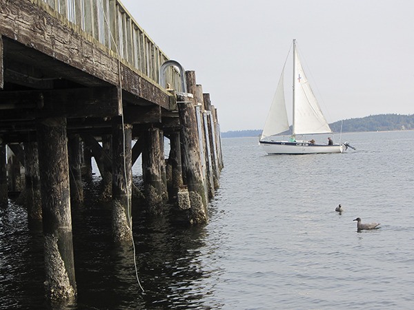
An increase in sea level rise, more frequent flooding and accelerated bluff erosion are among the local changes expected to occur in response to climate change. In Sequim, some of the most vulnerable communities to sea level rise are those built on low-lying areas like the Dungeness River delta and Diamond Point and those higher up, but bordering coastal bluffs.
“Much of the focus of this project was looking at long-term planning, but we need to be thinking about the short-term, too,” Miller said. “The way that climate change manifests early on is more extreme, damaging events.”
To help educate communities spanning from Neah Bay to Port Townsend on climate change and the projected impacts, Miller and Cindy Jayne, project manager with the North Olympic Development Council, will discuss the results of a collaborative project aimed at identifying local vulnerabilities and the development of adaptation strategies on Thursday, Aug. 27, at the Dungeness River Audubon Center.
Presenting the project results across the North Olympic Peninsula is one of the final components of the project that started last June and is coming to a close in October, Jayne said.
“The good news is that we have an opportunity to prepare for the expected changes,” she said. “The more we can do to prepare, the better we’ll be able to adjust.”
Assessing local vulnerability
Miller and Jayne were among a diverse group of community partners working on a climate change vulnerability assessment and consequential adaptation strategies.
The project combined the detailed process of reviewing existing research, literature and data specific to the area with ongoing guidance from consultants with Adaptation International and conducting workshops to compile input from those that manage the various resources in the area, like the public utilities district for example.
“It really married science and research with the on the ground work going on here,” Jayne said.
One of the main deliverables of the project was to write a localized Climate Preparedness Plan. The plan is to be finalized at the end of the month.
To help inform jurisdictions and local planning processes, such as the current one to update the Clallam County Shoreline Master Program, project partners also developed a document that summarizes example planning language.
“It’s important to study climate change locally so we can make appropriate decisions in the future and avoid damaging risks,” Miller said. “Really, these things can set us up for a safer, cheaper future.”
The houses along coastal bluffs built on the outskirts of Sequim are an example where proactive planning measures, like increased setbacks for shoreline development could help reduce risks. As sea level rises in relation to climate change, the rate of coastal bluff erosion is expected to pick up pace.
“Development on coastal bluffs is shaping up to be a real struggle for this area,” Miller said.
Already, some homes built on eroding bluffs have been abandoned or are in the process of being relocated.
A focus on sea level
Although the project and resulting Climate Preparedness Plan take into account a wide range of impacts associated with climate change, such as projections for a “noticeable increase” in flooding in downtown Port Townsend during winter storm events within the next 15 years, according to Miller, Thursday’s discussion will primarily focus on sea level rise.
“Rates of sea level rise are almost certain to accelerate in the coming decades and that sea level rise will almost certainly lead to shoreline impacts for all three communities (Neah Bay, Port Angeles and Port Townsend) by 2100,” Miller said.
As a coastal hazardous specialist, Miller finds the North Olympic Peninsula a dynamic place to both conduct his research and live. One of the natural processes that makes the Strait of Juan de Fuca coastline even more complex to study is the differences in vertical land movement from Neah Bay to Port Townsend.
“In Neah Bay, the land is rising rapidly and has outpaced sea level rise,” he said. “As a result relative sea level has fallen in Neah Bay at a rate of approximately 7 inches per century.”
Whereas, in Port Townsend, Miller explained, the land is seemingly subsiding and thus the relative sea level has risen faster at about 6 inches per century. The estimated rate of sea level again differs in Port Angeles where the land is rising, but at a much slower rate than in Neah Bay.
“There’s a lot to learn here,” Miller said. “Really, we’re just starting to understand the risks.”
Globally, much of sea level rise can be attributed to two factors: increases in the amount of heat stored in the ocean (causing water to expand) and the addition of water volume to the oceans as land-grounded ice in Greenland and Antarctica has melted; Thus, the ability to make immediate impacts to sea level rise is unlikely, Miller said.
However, he added, looking at sea level projections for the next 100 years, the “magnitude” is largely “governed” by the amount of greenhouse gases added to the atmosphere.
